Friday, October 6, 2017

Sept 21 - Arches National Park

For recreation or for beauty, Moab, UT, is the place to stay when visiting either Arches or Canyonlands National Parks.  As we drove down the main street in Moab, Susan and I remarked how it reminded us of Gatlinburg in a way.  Very touristy but very pleasant.  Not quite as much neon as Gatlinburg.  Lots of places to stay; a great vibe for sure.  And everything outdoorsy you could want - bikes, kayaks, hiking gear and everything in between.

Arches National Park has the largest concentration of natural arches in the world. Our first stop was a sunrise view of Delicate Arch, probably the most famous of all the arches in the park. It is featured on the Utah license plate.


Balanced Rock - nuff said.


There is a trail leading up to Turret Arch and 2 arches called North Window and South Window.


To give you some perspective of the size, check out the people standing inside North Window.


Then a primitive trail goes around to the back of North and South Windows.  When combined, they're called The Spectacles.  Perfect name!


So hard to get perspective on this size of these arches. Over 2000 arches are cataloged in this national park, ranging from a 3-foot opening to the longest - Landscape Arch.


This was one of my favorites - Double Arch. Several million years ago, it started with water accumulating in a pothole on the top of the rock outcropping. Then water doing what water does and
pulled by gravity, it found a weak spot in the rock. Some water went one way and some went the other, creating Double Arch which expanded over the millennia with further water and wind erosion. Quite a process. One arch is 144 feet wide and 112 feet high; the other arch is 67 feet wide and 86 feet high.


This arch is called Tunnel Arch.  


And Pine Tree Arch.  The distinct line between the white and red sandstone is similar to what we saw in Canyonlands NP.


Another fav - Landscape Arch. This opening is over 300 feet wide, one of the widest spans in the world.  In 1991, a rock slab 60 feet long and 11 feet wide cleaved from the upper right side of Landscape Arch. You can see how that section is lighter in color.  Estimated to weigh 180 tons, the trail up and under this thin ribbon of an arch has been closed ever since.


Sand Dune Arch.


Susan reminded me that we were on the road home at this time last week, so we haven't even been home a week yet. Gotten a lot done, but more to do! I appreciate you sharing your time with me, checking out these incredible places to visit.  From living in the Grand Canyon to these incredible sights of Canyonlands and Arches, our country is blessed with such beauty. I've said often (and I mean it), I hope you will make time to see and experience these (and the many other) national parks.

My last tour, and now I'm ...

Great memories.  I hope you have a great fall and look forward to hearing from you.  Jordan

Monday, October 2, 2017

Sept 19 - Natural Bridges National Monument and a couple of summer visits

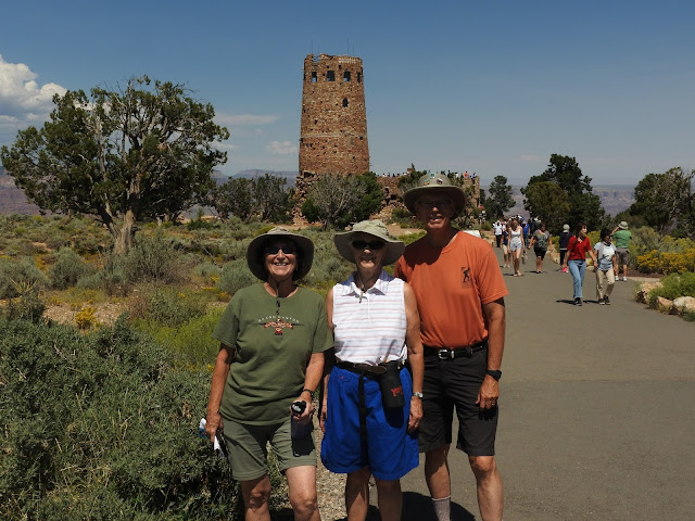
During our summer in the Grand Canyon, we were fortunate enough to have some family members visit. A close cousin, Ellen Kayser, came up from Phoenix for several days. We checked out each end of the GC - from the Watchtower at Desert View to Hermits Rest...and everything in between.


And a distant cousin from the Indiana Shenefields (who happens to live in Atlanta) came out as well.  Shelly Shenefield brought her sister Cindi along, and we had dinner at El Tovar Hotel Restaurant.


Great visits!  When Susan and I left Grand Canyon, we headed north into Utah towards Canyonlands and Arches National Parks.  But to get there, we went through an area called the Moki Dugway. Not sure why or where the tradition of putting stickers on the sign came from. I'd prefer just the sign. 
 

This is a very steep road with multiple switchbacks overlooking the San Juan River Valley. The valley below is also called Valley of the Gods. 


Then onto some of the most spectacular scenery in the world.  First stop, Natural Bridges National Monument. Anywhere else in the country, this would already be a national park. But competing with Zion, Bryce, Canyonlands, and Arches, this little pocket of 3 beautiful natural bridges is waging an uphill battle to join its larger and more well known siblings.


The 9 mile loop road through the park leads to trails which go to the 3 bridges. Easy access and good trails. The first is called Sipapu Bridge, the Hopi word representing their "place of emergence." Bridges are different from the arches that we'll see in a couple of days. Bridges are created as water streams through the weaving sandstone, eventually wearing down and finding a shorter path through the sandstone.  Arches certainly have a water component, but the main action there is wind and water (like rain) rather than a stream.  Sipapu Natural Bridge is the largest of the 3 bridges - 220' high and 268' across and 53' thick.


It's a difficult trail leading to Sipapu Bridge with ladders leading to the slickrock that formed the bridge.  . 


Geologically, Kachina Bridge is considered the youngest of the bridges. 210' high and 204' span and 93' thick. The same creek has carved both Sipapu and Kachina Bridges.


Our oldest bridge no longer has a stream running under it. Owachomo means "rock mound," a feature on top of the bridge's east abutment.    


This is the thinnest (and therefore the oldest) of the bridges...only 9' thick.


Still this span is 106' high and 180' wide.


I took this panorama lying on my back underneath Owachomo.


With the seclusion of this area and good availability of water, it's only natural that Native Americans built a civilization there.  Again they didn't stay long (enough time to build their homes into cliffs). But left behind very limited information as to "why" they left.


Layer upon layer of sandstone. 


On our hike to Kachina, it was VERY windy and we ran across this sign.  However, there was no electricity in the air today!


We left Natural Bridges and spent the night in Blanding, UT before heading to Canyonlands NP the next day. On the way, we saw the controversial Bears Ears National Monument. Here are the Bears Ears and the story of how they got that way.  


Last blog coming up - Arches National Park.  


Thursday, September 28, 2017

Sept 20 - Canyonlands National Park

While in Yellowstone and Grand Canyon National Parks the past 2 summers, I often said that each and every national park is unique and special.  Canyonlands National Park in east central Utah certainly nails that definition!!  Susan and I explored only one of the 3 districts in Canyonlands. Called the Needles, it is on the east side of the park and is spectacular.  The other districts are called Island in the Sky and The Maze.  On the west side of the Colorado River, The Maze is one of the most remote areas in the the lower 48 states. No roads; hard to get to; we'll never get there. However, in the northern section, Island in the Sky is an area we will definitely come back to.  Staying in Moab, UT, is the perfect place to enjoy both Canyonlands and Arches National Parks.

To reach the Needles District, we had to drive 35 miles from the main road.  We saw this feature on the way to Canyonlands; I called it "The Capitol." Beautiful, but only a hint at what we'd see inside the park.

Along the way, there was a place called Newspaper Rock. This petroglyph tells many stories. Check out the herd of deer in the upper left; a hunter shooting elk in the upper right; several bear claws and big horn sheep. And some are just designs.


On the way into Canyonlands, we had to stop at the sign and get our first look at this very dry and stark landscape.


We didn't know it when we started hiking, but this is how the Needles District got it's name. Well done!

Our first hike - a short 6/10ths miler around an area called Cave Spring. It contained an old cowboy camp. Easy to understand why cowboys would like it here: nice shady overhang to ward off the intense summer heat; good source of water nearby.


Nice storage box too. 


One of the things we found so unusual is the very distinct line between the red sandstone and white sandstone. Iron oxide mixed with the red sandstone while the white sandstone remained like the sand you find at the beach. It only takes a little color red to make a significant color change.


Susan's on the white sandstone. Amazing to think how clearly defined that line between the red and white sandstone is.


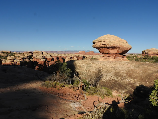
We did see a number of mushrooms and balanced rocks.


Love the tree growing out of the middle of the rock. Tough existence.


Our longer 6 mile hike went up and down 2 ridgelines before reaching Chesler Park.  This is how the Needles District got it's name.

Some rugged hiking; very exposed, meaning hot and dry.  


And narrow too! Several times we had to wait for hikers coming towards us to clear the constricted passageways.


Great beauty, going and coming. Completely different views on the way back.


Couldn't resist a funny picture.


Finally made it back. This is our last downhill. You can see the car in the background. I had not taken enough water; bad planning on my part. But we had the salty snacks we needed and then had a generous lady give us some water that she didn't need (she was headed back and had plenty). So that was VERY helpful.  


This little arch is called Wooden Shoe. Good overlook on the way back to the visitor center and more water.


Yes, Needles District of Canyonlands, we will be back! And I hope you go there too.


Next up...Arches National Park.