


Great visits! When Susan and I left Grand Canyon, we headed north into Utah towards Canyonlands and Arches National Parks. But to get there, we went through an area called the Moki Dugway. Not sure why or where the tradition of putting stickers on the sign came from. I'd prefer just the sign.

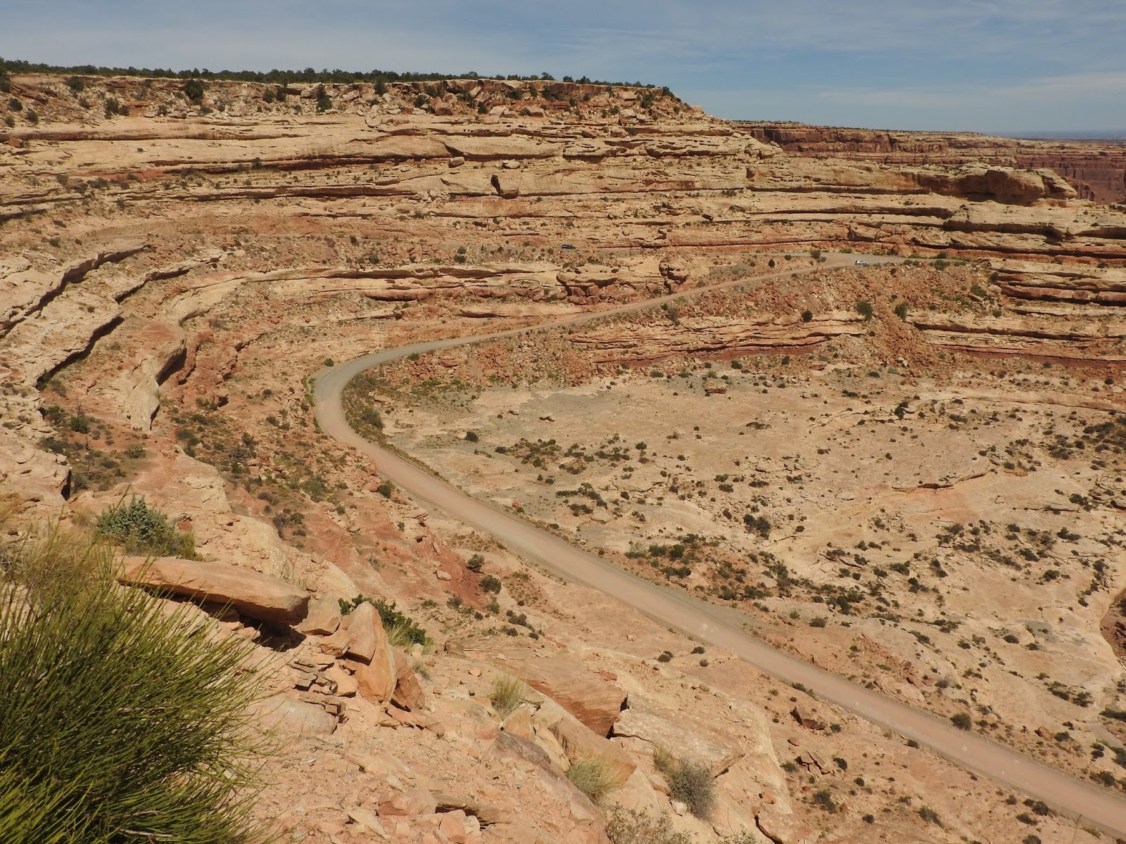
This is a very steep road with multiple switchbacks overlooking the San Juan River Valley. The valley below is also called Valley of the Gods.


Then onto some of the most spectacular scenery in the world. First stop, Natural Bridges National Monument. Anywhere else in the country, this would already be a national park. But competing with Zion, Bryce, Canyonlands, and Arches, this little pocket of 3 beautiful natural bridges is waging an uphill battle to join its larger and more well known siblings.

The 9 mile loop road through the park leads to trails which go to the 3 bridges. Easy access and good trails. The first is called Sipapu Bridge, the Hopi word representing their "place of emergence." Bridges are different from the arches that we'll see in a couple of days. Bridges are created as water streams through the weaving sandstone, eventually wearing down and finding a shorter path through the sandstone. Arches certainly have a water component, but the main action there is wind and water (like rain) rather than a stream. Sipapu Natural Bridge is the largest of the 3 bridges - 220' high and 268' across and 53' thick.

It's a difficult trail leading to Sipapu Bridge with ladders leading to the slickrock that formed the bridge. .

Geologically, Kachina Bridge is considered the youngest of the bridges. 210' high and 204' span and 93' thick. The same creek has carved both Sipapu and Kachina Bridges.

Our oldest bridge no longer has a stream running under it. Owachomo means "rock mound," a feature on top of the bridge's east abutment.

This is the thinnest (and therefore the oldest) of the bridges...only 9' thick.
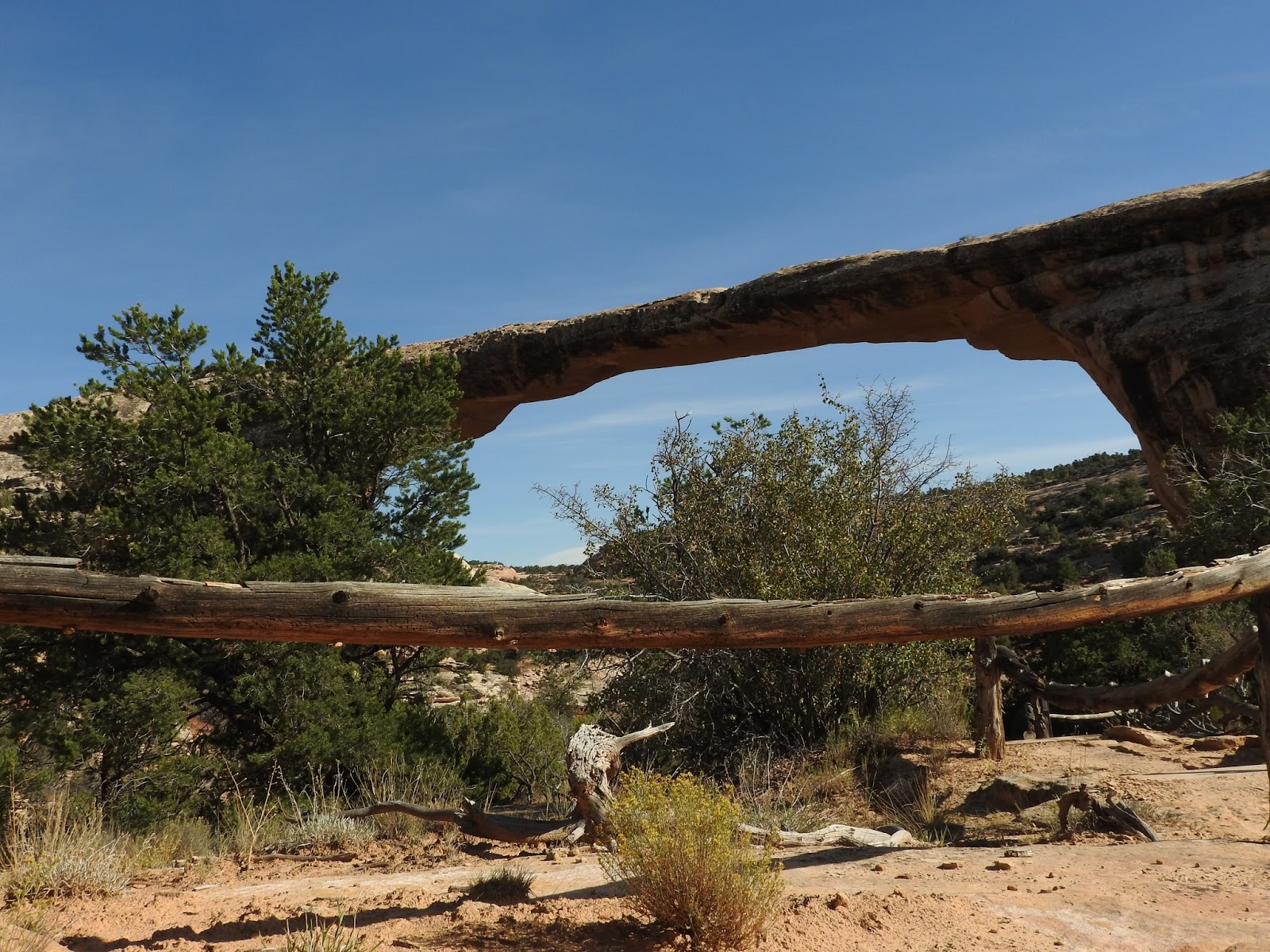
Still this span is 106' high and 180' wide.

I took this panorama lying on my back underneath Owachomo.

With the seclusion of this area and good availability of water, it's only natural that Native Americans built a civilization there. Again they didn't stay long (enough time to build their homes into cliffs). But left behind very limited information as to "why" they left.

Layer upon layer of sandstone.

On our hike to Kachina, it was VERY windy and we ran across this sign. However, there was no electricity in the air today!

We left Natural Bridges and spent the night in Blanding, UT before heading to Canyonlands NP the next day. On the way, we saw the controversial Bears Ears National Monument. Here are the Bears Ears and the story of how they got that way.


Last blog coming up - Arches National Park.
No comments:
Post a Comment